
Pennsylvania Neighbors by Block
A block search starts with parcels and public-facing groups, not a list of everyone inside nearby homes. The records below answer different questions: a county map identifies the lots beside an address, an assessment card names an owner, and a public association page may show where neighbors meet. Pennsylvania has no statewide directory of association members. A row on a tax roll describes an ownership link, not who currently lives in the building.
| Source | What It Shows About a Block | Access |
|---|---|---|
| County GIS parcel viewer | Adjacent parcel outlines, parcel IDs, municipal borders and map layers | Free county viewer where offered; county detail varies |
| County assessment card | Owner, situs and tax-mailing addresses, value and exemption | County portal or counter; not a household list |
| Recorder or subdivision plat | Lot, block, easement and recorded ownership links | County Recorder, archive or available online index |
| Public voter-status lookup | Whether a searched voter is registered and polling details | Person-led state form or county office |
| Voter-file request | Address, status and history fields within the approved file | $20 electronic file; affirmation and publication limits |
| Municipal permits and code files | Work, applicant, owner or contractor and case date | Municipal portal or narrow records request |
| Historic reverse directory | Some listed occupants or phone subscribers by address | Library print or microfilm; year and name gaps |
| Association or civic page | Boundaries, meeting place, public contact or activities | Local group or municipal page; rosters are usually private |
| Commercial neighbor-data category | Compiled public or purchased address links | Not authoritative; may be stale or incomplete |
Owners and occupants can differ. A tax mailing address may belong to an owner who lives elsewhere, while a renter or household member may not appear in an owner index at all. Use the map to define the immediate area, then check the source record for each parcel rather than assuming that a map label names everyone nearby.
Mapping Pennsylvania Neighbor Parcels
Begin with the known address in its county GIS viewer. Select the parcel and record its ID, owner field and municipality. Click the polygons sharing a boundary, or pan along the same block face. Some viewers offer a select-by-polygon or buffer tool; eMapPA lets a user choose point, line or polygon buffers, set a distance, select map layers and create or clear the buffer. This gives a repeatable area to inspect instead of a vague radius.
- Find the address in the county map and note the parcel ID.
- Click each touching parcel, then record the owner and situs fields.
- Open the county assessment card to compare the tax-mailing address and any exemption.
- Check a plat or Recorder index if a boundary or ownership link is unclear.
The state PA Parcels layer can help discover parcel IDs and owner fields, but county assessment cards remain the source for authoritative local values and mailing details. For a full named-street chain, continue with the Pennsylvania street directory, which follows address records along a street.
Pennsylvania County Maps Shape Neighbor Searches
Pennsylvania's 67 counties are autonomous in local mapping and assessment. Some provide a detailed viewer, others a basic parcel index, and some require a courthouse or assessment-office visit. The statewide GIS route is for discovery: PASDA, the Commonwealth's GIS data access page and eMapPA point toward layers, but they do not replace the county card.
Municipal borders, school districts and parcel lines can cross the area that people call a neighborhood. A postal city name may not match the borough or township that keeps permits and tax data. Check the municipality attached to the parcel before contacting an office. Address points and road layers used for emergency mapping help locate a structure, but statewide address points do not carry residents' names.
When a block sits near a borough line or an old subdivision, compare the current map with the recorded plat and the county Recorder's legal description. A narrow strip, alley, railroad parcel or common area may touch a lot without being another household. Date the map view and note which layers were on when recording the search.
Pennsylvania Voter Records on a Block
The Department of State status form searches one voter at a time, and the county registration office is the fallback when a name does not match online. It can show registration and polling information, not a browsable list of every elector on a street. A registration entry may lag a move or use a different name form, and a protected voter may appear at a substitute address.
The state's full voter export is controlled by the Department of State request form. It costs $20 for one county or all counties, arrives electronically and requires a signed affirmation. Use is limited to elections, political activity and law enforcement; Internet publication is prohibited under 4 Pa. Code §§ 183.13(g) and 183.14(k). Public fields can include names, residential and mailing addresses, status, party, districts and voting history, but protected identifiers are restricted. A block map should therefore stop at parcels, districts and public civic contacts rather than publish voter names or addresses.
Ballot choices are never part of this trail. A voter record can show whether someone participated in an election, not whom they supported.
Pennsylvania Neighborhood Association Records
A local association can help identify a neighborhood's boundary, meeting place or public contact, but Pennsylvania has no statewide member directory. Start with the municipality's neighborhood page or county planning and community-development office. The routes below are public starting points, not rosters of private households.
| Public source | What it can offer | How to use it |
|---|---|---|
| Municipal neighborhood page | Local civic contacts, district maps or meeting details | Match the parcel's municipality to its page |
| Philadelphia Registered Community Organizations | RCO boundaries, resources and public meeting information | Use for Philadelphia addresses only |
| County planning or community-development office | Neighborhood plans, civic councils and group contacts | Ask which group covers the address |
| HOA or condominium association | Recorded declarations or management contact | Member and household lists are not public records |
| Chamber, congregation or block watch | Public business, service, officer or safety information | Respect each group's private roster rules |
Philadelphia's official Registered Community Organizations directory is a concrete local example of a boundary and public-meeting resource.
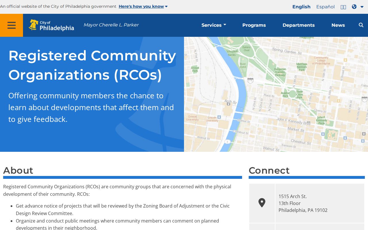
The Philadelphia directory identifies a formal civic layer, not the full list of people who live within an RCO boundary. Elsewhere in Pennsylvania, use the city, borough or township site to find the right local route.
Pennsylvania Civic Records for a Block
Community records can help make sense of a block without naming every neighbor. Libraries, historical societies and university archives preserve local newspapers, maps, yearbooks, church material and neighborhood files. The Historical Society of Pennsylvania digital collections includes manuscript, ethnic and community material, but its online catalog covers only part of its holdings; ask an archivist about finding aids or physical collections.
Congregations, veterans posts and civic clubs may publish service times, officers, newsletters or public event notices. Their member lists are usually private. A chamber directory can identify a business or local institution, not the people who live in nearby homes. For a personal reconnection, a school yearbook or alumni collection is a better fit than trying to turn a neighborhood organization into a household index.
Ask the library for the exact years and format it holds before a visit. A shelf volume, microfilm reel and searchable online file may cover different periods.
Pennsylvania Permit Records by Block
Building permits and code files can add dates to a block's story. Depending on the municipality, a record may name a project, applicant, owner or contractor and show the case date. Some cities publish a portal; elsewhere the permit desk or municipal records officer is the entry point. Permit coverage does not create a list of residents, but it can explain why a parcel changed shape or use.
If the online file is missing, ask the municipality for an existing permit by address and date range. The Pennsylvania Right-to-Know Law is a way to request public records from the agency that holds them, not a request for staff to map every neighbor. Use the state online request form or the local open-records officer; describe the property, permit type and date window as clearly as possible.
A building, street or district can straddle different local offices. Confirm whether the address lies in a borough, township or city before asking for code history, inspection files or subdivision records.
Pennsylvania Historic Directories List Residents
Reverse directories can turn an old address into a name, but only for the people and years the publisher listed. The Free Library of Philadelphia's Cole's reverse-directory run includes microfilm for 1973-2007 and print volumes for 2009-2020. Those are Philadelphia holdings, not a statewide run. The library's house-history guide explains how to pair directory entries with deed records and street-name tables.
Use a dated entry as a snapshot, then check the next directory year or an obituary, deed or census record. A reverse directory may list a subscriber or head of household rather than each occupant. Outside Philadelphia, ask the local library or historical society what print, microfilm or digitized directory years survive.
Directories and old maps help describe how a block changed; they do not establish who lives there now. For a present-day parcel, return to the county assessment office and verify the current owner field.
Privacy Limits for Pennsylvania Neighbors
A parcel record may show an owner, but it does not prove who occupies each unit. Renters, household members, utility customers and delivery recipients are not assembled into a public block roster. Pennsylvania's Address Confidentiality Program gives eligible survivors a substitute address for many government records, including voter registration; it renews every three years and does not erase every older record.
Official sources and commercial neighbor-data services also differ in what they can prove. A county assessment card is tied to a parcel and custodian; compiled services may combine public and purchased data, show old addresses, merge people with similar names or place details behind a fee. Neither category should be treated as a complete list of current occupants.
| Source type | Useful for | Limit |
|---|---|---|
| Official GIS and assessment records | Parcel boundaries, owner and tax-mailing details | Do not establish household membership or current occupancy |
| Public association pages | Group boundaries, meetings and public activities | Usually no full member list |
| Commercial compiled data | Possible address leads from mixed sources | May be stale, mismatched or incomplete; verify at source |
For an address error, contact the assessment office; for a voter issue, contact county registration staff. Pennsylvania stalking law, 18 Pa.C.S. § 2709.1, addresses repeated conduct meant to cause fear of bodily injury or substantial emotional distress.
Lawful use. Use parcel and civic information for ordinary community research. Do not use an address trail to watch, threaten, harass or intimidate a neighbor.