
Follow a Pennsylvania Address Trail
For Pennsylvania street research, use a chain rather than one master list. County assessment offices identify taxable parcels, GIS maps them, and Recorders of Deeds index transfers. Permits add work dates. Voter status and historic directories add other clues, but neither is a household roll. Keep the address, municipality, parcel number and legal description together; they distinguish properties when street and postal names overlap.
- Locate the county. The Pennsylvania State Archives' courthouse guide routes an address to its county. No statewide assessment or deed portal exists.
- Find the parcel. Search the county card by situs address. Save its parcel number, municipality and legal description. The listed owner is the taxable owner, not proof of occupancy.
- Map the place. In the county viewer or eMapPA, identify the parcel and note roads and municipal lines.
- Read the deed trail. Search the current grantee and legal description. Follow the grantor backward, then ask for books, microfilm or archive help if the index ends.
- Add time clues. Check municipal permits and a reverse directory. The public voter form checks one named elector, not a whole street.
Use deeds for transfers and directory years for listed past occupants. The Pennsylvania street directory organizes evidence; it does not name every person at an address.
Pennsylvania Tax Mail and Situs
A tax card may show a situs address, the parcel's physical location, and a mailing address for bills. The mailing address can be elsewhere in Pennsylvania or out of state. It can help locate an owner, but does not show where that person lives. A homestead exemption supports an owner-occupancy inference, not direct resident verification.
Search by owner, situs or parcel key, then note the assessment year, sale data, municipality and exemption. Fields vary by county. The state parcel layer helps with discovery, but the county assessment office holds authoritative tax values and mailing details.
| Assessment search field | Entry or format | Use and local limit |
|---|---|---|
| Street number | Text; numeric, fractional or range formats vary | Try the house number as shown in the local address record. |
| Street name | Text or autocomplete | Test abbreviations, directionals and older names. |
| Municipality | Optional city, borough or township selection | Separate similarly named places. |
| Owner name | Optional text | Partial matching and entity names vary. |
| Parcel, UPI or account | Optional county-specific number | Use an exact key when another record provides it. |
| ZIP or property class | Optional field where offered | A ZIP filter returns tax parcels, not households. |
| Search or Clear | Button or map/list control | Labels and result modes differ by county. |
- Parcel
- A mapped or numbered piece of land used in a local tax and property record.
- Situs address
- The street address tied to the parcel's physical location.
- Mailing address
- The destination for tax mail, which can differ from the situs.
- UPI or account number
- A county's parcel key; Pennsylvania has no single statewide number format.
- Plat
- A recorded map that shows lots and lines in a subdivision.
- Criss-cross directory
- A historical book that starts with a street address and may list a resident's name.
Pennsylvania GIS Street Layers
Use the county GIS viewer to search an address or parcel, select its polygon and open the popup. Turn on parcel labels, roads and municipal lines; other county layers may cover zoning, flood risk, schools, districts, watersheds or historic sites.
DEP's eMapPA map offers address, county, municipality and ZIP locators, plus identify and buffer tools. The image shows its statewide locator.
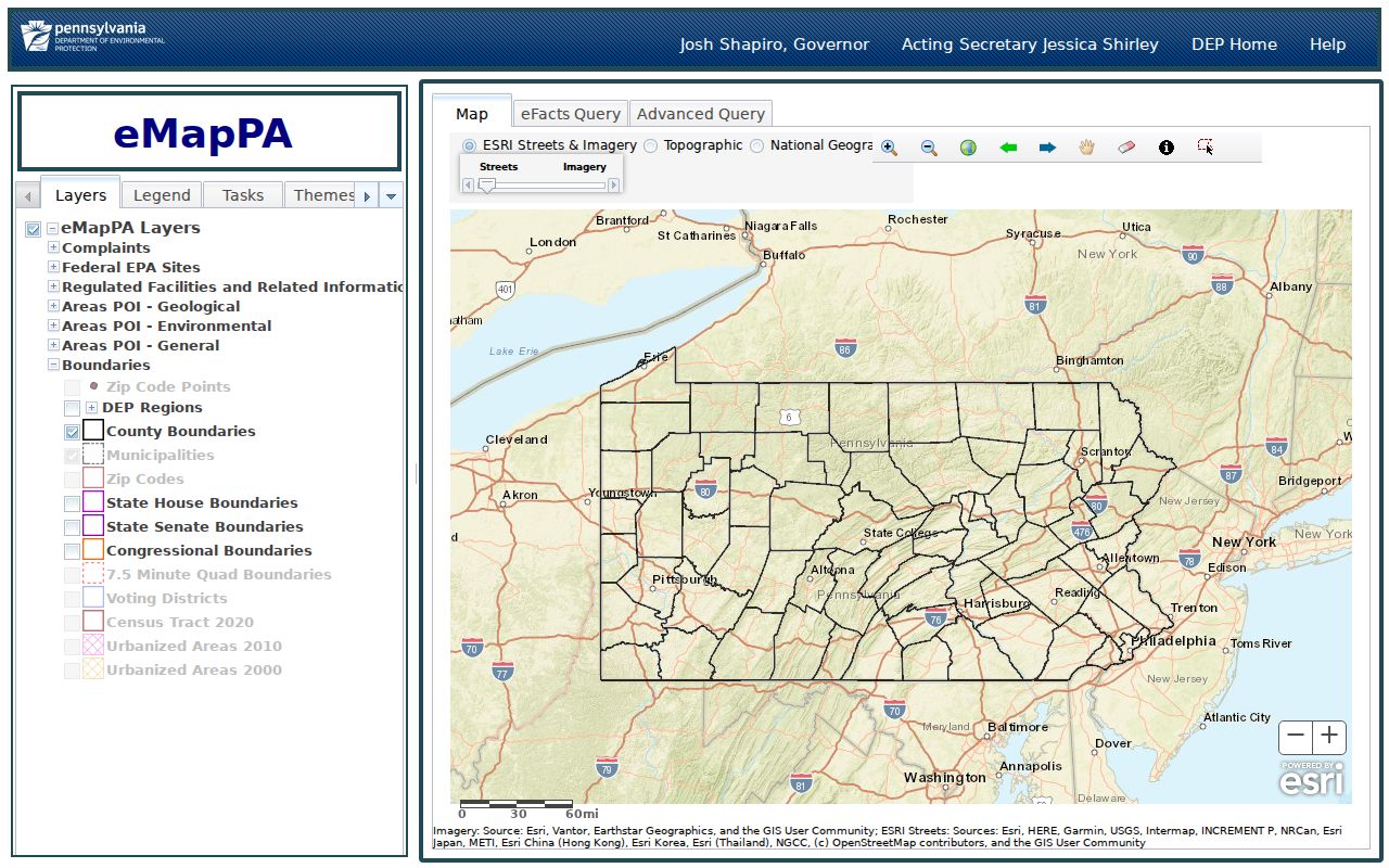
Use the state map for location, then return to the county viewer for parcel detail. A street search may miss a unit, private road or parcel with another postal city.
| eMapPA field or tool | What it does | Street-search use |
|---|---|---|
| Address | Finds a mapped address | Start near a street number, then inspect the local parcel. |
| County | Moves the map to a county | Choose the county that holds the tax and deed records. |
| Municipality | Narrows to a local jurisdiction | Separate a town or township from its postal city. |
| ZIP | Centers the map on postal geography | Use for orientation, not as a household list. |
| Latitude/longitude | Centers the map on coordinates | Use when a parcel or site has a map point. |
| Identify and buffer | Queries map layers or a selected area | Inspect parcels and a nearby area where enabled. |
Use whole-street mode where a county offers it; otherwise pan the map and click each parcel. A ZIP filter finds tax parcels assigned that postal area, not everyone receiving mail there. Some street views omit units, private roads or parcels with another postal city.
Pennsylvania Parcel Records on Streets
The statewide PA Parcels layer is a cross-county discovery tool. Its fields include parcel ID, account, owner, property address, city, ZIP, county, district and acreage. It returns geometry, not a deed image or a guaranteed current tax value; compare it with the county card.
A result can show:
- Identity: parcel ID, account number, owner name and name extension.
- Location: property address, city, state, ZIP, county name, county code and district.
- Land: acreage, parcel shape and geometry measures.
- Not included: personal phone, voter record, utility subscriber or household-member details.
The statewide PA Parcels layer shown below should be checked against the county assessment card and Recorder's index.
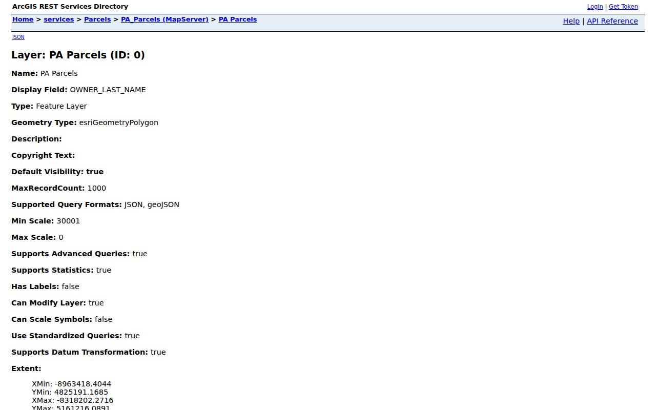
Use the local index and request route for deeds and tax records; the map layer is for discovery.
Pennsylvania Street Records by Source
Assessment cards name taxable owners; deeds record transfers; GIS locates parcels; permits describe work. Pennsylvania's 67 counties differ in web access and older coverage, so a counter, microfilm or archive may be needed.
| Record set | Keeper | What it can show | Access route |
|---|---|---|---|
| Assessment card | County assessment office | Taxable owner, situs and mailing addresses, parcel, value, exemption and sale details. | County search or GIS; request or counter if not online. |
| GIS parcel | County GIS, PASDA or PA Parcels | Polygon, parcel ID, owner/address fields and nearby map layers. | Viewer or data download; county detail is authoritative. |
| Deed index and image | County Recorder of Deeds | Grantor, grantee, legal description, recording date, liens and easements. | County web index, counter, microfilm or FamilySearch; copies may cost. |
| Plat or subdivision | Recorder or planning office | Lot, block, parcel splits and right-of-way. | Recorded plan, local planning file or map. |
| Permit or code case | City, borough or township | Work date, applicant, owner or contractor, status and inspection event. | Local portal or a focused records request. |
| Tax or sheriff-sale notice | County Treasurer or Sheriff | Tax status or scheduled sale event, not final title. | County notice or portal; verify ownership in the final deed. |
| Voter status | Department of State or county elections office | Status and polling information for a searched elector. | Official name-led search or county office, with protected fields withheld. |
| Reverse directory | Library or historical society | Listed occupant, phone and sometimes length of time at an address. | Print, microfilm or local digital collection, with year gaps. |
Use the parcel number to join a tax card, deed and permit. A plat, address change or owner with several lots can break a street-name-only search.
Deed Chains Across Pennsylvania Streets
For ownership history, find the latest deed where the current owner is grantee. A grantee receives property; a grantor conveys it. Record the grantor, date, document or book/page number, municipality, consideration and prior deed reference. Search the grantor as the next grantee. If an estate, trust or company appears, search its name too.
There is no statewide online cutoff. In Philadelphia, the Department of Records and City Archives guide describes deed holdings for 1683-1955, historic images for 1683-1973 and PhilaDox search for 1974 to the present. Elsewhere, ask the county about its index, deed books, counter, microfilm or archives. The State Archives county guide and selected FamilySearch records can help when a web index ends. Images, printing and certified copies may cost extra.
For each deed index result, note the fields that connect the record to the next search:
- Grantor and grantee names.
- Document type and recording date.
- Book/page or instrument number.
- Municipality, legal description and consideration reference.
- Whether an image is linked or must be requested.
Follow a cited book, page or instrument number. A deed does not show where a seller moved or who lived at the property.
Pennsylvania Plats and Lot Numbers
A plat maps subdivision lots and lines. It can explain a parcel split or an address that now points to a different number. Pennsylvania UPI formats vary by county, and legal descriptions may use lots, metes and bounds, tracts, surveys or deed references.
If an address search fails, compare the deed's lot, block and municipality with a plat or tax map. Legal descriptions often outlast street numbers. For an older property, search the parent county or former municipality; a new boundary does not move an old deed into a new book.
Permits for Pennsylvania Addresses
Permits and code cases date construction or alteration, not an owner change. Search a municipal portal by address, parcel, permit number or date. Capture the case number, applicant, contractor, work description, status and inspection result. A code notice may be out of date.
If no online index exists, ask the municipal records officer for address- and date-bounded permit or code entries. A street-opening or building permit can show that a structure existed or changed; a plat can connect it to a later parcel. Neither is a household roster. The request should name a record type and date range, since permits are held by city, borough or township offices rather than by one statewide permit index.
Pennsylvania Voter Data by Address
The Department of State's status form searches one elector; the county office and 1-877-VOTESPA are fallbacks. A result may show status and polling details. A blank result can reflect a spelling, county or status change, not an empty address.
The separate voter-list request form offers public information or a full export for $20 per county or statewide, by electronic delivery. It requires an affirmation for permitted election, political activity and law-enforcement uses. The export may include addresses, districts and vote history; Internet publication is barred, and signatures and unique identifiers are restricted. Protected voters and ACP participants may not show a true address.
A status match is not a household list and never shows ballot choices. Keep the Pennsylvania street directory's voter detail to this narrow cross-check.
Pennsylvania Reverse Street Directories
A reverse directory starts with a street number and gives a listed name, sometimes a phone number or length-of-stay note. Cole's Cross Reference Directory covers 1973-2007 on microfilm and 2009-2020 in print at the Free Library. These Philadelphia years are not statewide. Ask another local library about its runs and gaps.
Compare the street-number listing with the same year's alphabetical directory and check the abbreviation key. The Pennsylvania directory collections page covers the historical shelf; the reverse listing is one clue alongside tax and deed records.
Pennsylvania Street Name Changes
Philadelphia's 1898 and 1910 directories convert old street names to new ones; the Historic Street Index helps match an old entry to a current address. This matters when a deed or directory uses a name missing from today's map.
Other Pennsylvania towns may have renumbering, annexation or rural-route changes. Check local directories, ordinances and legal descriptions. The Free Library guide lists Philadelphia tools; elsewhere, ask a library or historical society.
Pennsylvania Street Limits and Privacy
A tax card names an owner, not every person who lives at the property. A deed records a transfer, not a current occupant. Voter status identifies a registered elector, not a household. Motor-vehicle address records are protected under the federal Driver's Privacy Protection Act, and utility subscriber lists are not public records. A commercial parcel layer cannot fill those gaps, and a protected address may be intentionally absent from public display.
Use the Pennsylvania street directory for lawful personal research, property history and civic questions. Verify a record with the office that keeps it, and do not use an address trail to stalk, harass or intimidate a person.
Respect privacy. Public parcel and deed records have limits. Do not try to expose protected addresses or use these records to contact, threaten or harm someone.